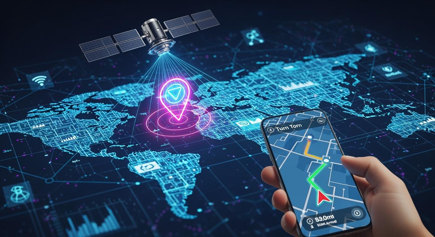
Imagine a world without digital maps, ride-sharing apps, or instant package tracking. It’s nearly impossible, thanks to the Global Positioning System, or GPS. This satellite-based technology has evolved from a exclusive military tool into an invisible utility that powers our daily lives. From guiding your road trip to enabling complex scientific research, GPS technology is the backbone of modern geo-location services. In this comprehensive guide, we’ll demystify how GPS works, explore its vast applications, and even look at the ground-based infrastructure, like high-speed optical transceivers, that makes it all possible.
📍 Key Takeaways
GPS lets you know where you are on Earth by using satellites.
You need at least four satellites for GPS to work well. This is called trilateration.
GPS helps with things like driving, walking, and finding places close by.
Businesses use GPS to track cars, manage groups of vehicles, and keep people safe.
GPS keeps getting better, so it will be more accurate and have new features soon.
📍 What Exactly is the Global Positioning System?
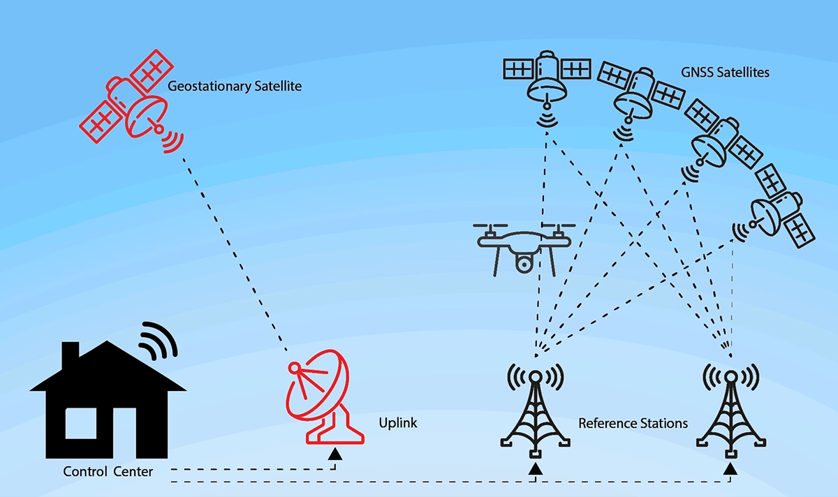
The Global Positioning System (GPS) is a U.S.-owned utility that provides users with positioning, navigation, and timing (PNT) services. It consists of three core segments:
The Space Segment: A constellation of at least 24 satellites orbiting the Earth, ensuring that several are “visible” from any point on the globe at any given time.
The Control Segment: A global network of ground facilities that monitor the satellites, update their orbital positions, and synchronize their atomic clocks.
The User Segment: The millions of GPS receivers found in your smartphone, car, smartwatch, and specialized equipment.
This robust system is a marvel of engineering, allowing for unprecedented location accuracy and real-time tracking across countless industries.
📍 How Does GPS Work? The Magic of Trilateration
At its core, GPS operates on a simple principle: trilateration. Your GPS receiver calculates its distance from multiple satellites to pinpoint its exact location on Earth. Here’s a step-by-step breakdown:
The Signal: Each GPS satellite continuously transmits a radio signal containing its precise location and the exact time the signal was sent.
The Calculation: Your GPS receiver picks up these signals. Since the signals travel at the speed of light, the receiver can calculate its distance from each satellite based on the time delay between transmission and reception.
Pinpointing Location:
1 Satellite gives you a possible location sphere.
2 Satellites narrow it down to a circle where the two spheres intersect.
3 Satellites provide a precise 2D location (latitude and longitude).
4 or More Satellites are required for a highly accurate 3D position, including altitude.
This process, happening in milliseconds, is what allows for turn-by-turn navigation and precise asset tracking for logistics.
📍 Beyond the Map: Key Applications of GPS Technology
The utility of GPS extends far beyond finding the nearest coffee shop. Its high-accuracy positioning capabilities are critical in numerous fields:
Application Sector | Specific Use Cases | Impact |
|---|---|---|
Transportation & Logistics | Fleet management, route optimization, autonomous vehicles | Reduces fuel costs, improves delivery times, enhances safety. |
Agriculture | Precision farming, automated tractor guidance | Increases crop yield, optimizes resource use (water, fertilizer). |
Disaster Response & Surveying | Mapping disaster zones, land surveying, construction | Enables rapid response, ensures engineering accuracy. |
Personal & Wearable Tech | Fitness tracking, location sharing, geofencing | Promotes health, provides safety and convenience. |
Scientific Research | Tracking animal migration, tectonic plate movement | Provides vital data for environmental and geological studies. |
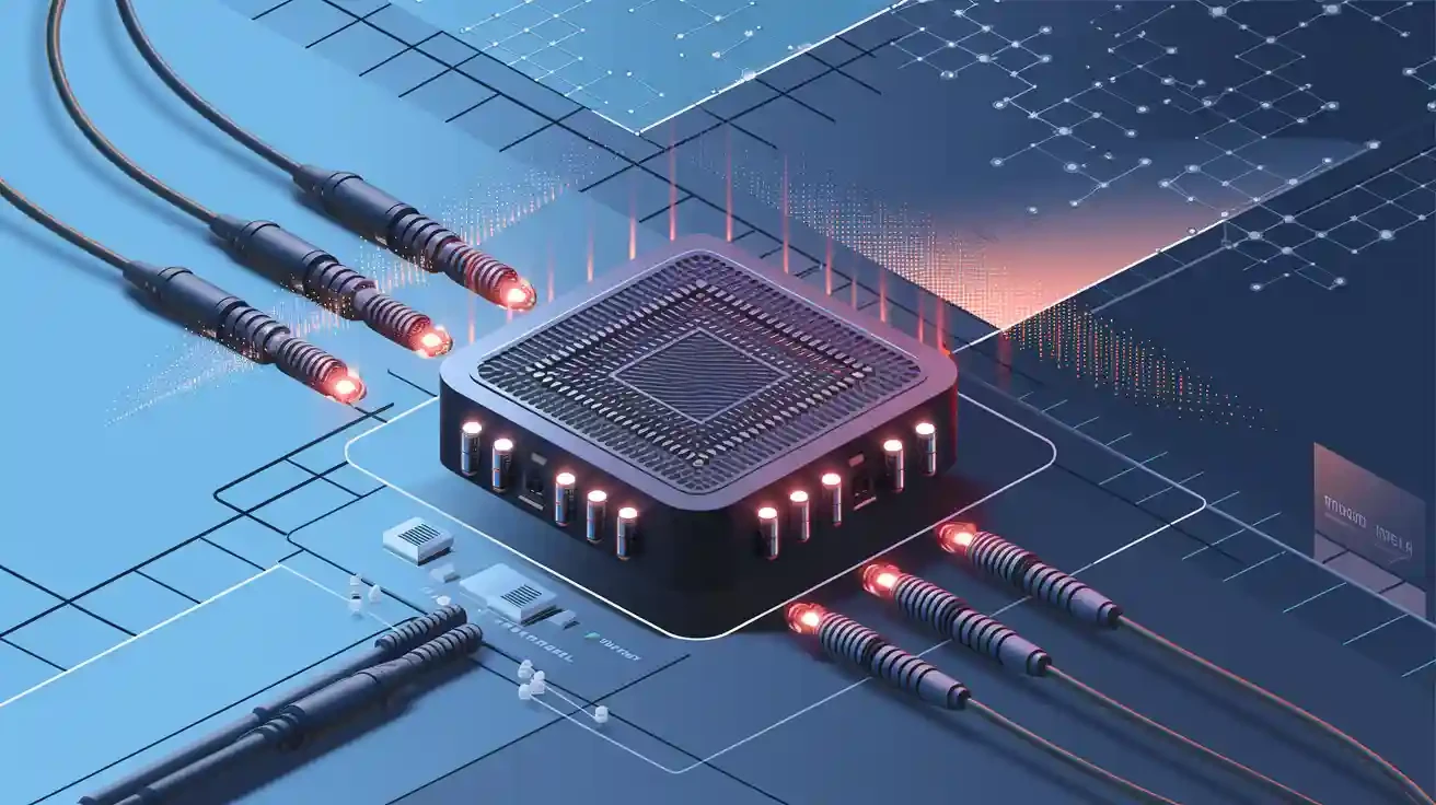
📍 The Unsung Hero: Optical Modules in GPS Data Infrastructure
While the satellites get all the glory, the ground-based infrastructure that processes and distributes GPS data is equally impressive. The control segment and data centers responsible for real-time GPS data processing require immense bandwidth and ultra-low latency to handle the constant stream of information. This is where high-speed fiber optic communication comes into play.
Fiber optic networks transmit data as light pulses, and at the heart of these networks are optical transceiver modules. These modules convert electrical signals from servers into light signals and vice versa, enabling the high-speed transfer of vast datasets—including the raw data used to calculate and correct GPS signals.
For instance, in a major data center processing global satellite navigation signals, reliability is non-negotiable. High-performance optical modules, such as the LINK-PP QSFP28-100G-SR4, are often deployed. This specific module offers high density, low power consumption, and robust performance over long distances, ensuring that the critical timing and positioning data from the GPS constellation are processed and disseminated without delay. When evaluating high-speed data center connectivity solutions, the quality of these components is paramount for maintaining the integrity of services we rely on every day.
📍 Challenges and the Future of GPS
No technology is perfect. GPS faces challenges like signal blockage in urban canyons, indoor positioning inaccuracies, and vulnerability to jamming or spoofing. The future lies in multi-constellation systems (combining GPS with Galileo, GLONASS, and BeiDou) and advanced GPS signal augmentation techniques.
The integration with other technologies, like 5G and Inertial Navigation Systems (INS), promises even greater location accuracy and reliability for emerging applications like drone delivery and fully autonomous transportation.
📍 Conclusion: Navigating a Smarter Future
The Global Positioning System is a foundational technology that has seamlessly integrated into the fabric of our society. From the satellites in space to the fiber optic cables and advanced LINK-PP optical modules on the ground, it’s a symphony of engineering that delivers the simple yet powerful gift of knowing “where.”
As we move towards an increasingly connected and automated world, the demand for precise, reliable, and instant location data will only grow.
📍 FAQ
What can you do if your GPS is not working?
You can move to an open area where your device can see the sky. Check your device settings to make sure GPS is on. Restart your device if needed.
What makes GPS different from a map?
GPS shows your real-time location using satellites. A map gives you a picture of places but does not track your movement or show your exact spot.
What devices use GPS today?
You use GPS in smartphones, cars, smartwatches, and fitness trackers. Many delivery trucks and airplanes also use GPS for navigation and tracking.
What should you do to keep your GPS accurate?
You should keep your device updated. Use it outside for the best signal. Avoid tall buildings or thick trees that can block satellite signals.